Torn between the drama of the Hudson River and the breezy harbors of the Long Island Sound? If you are exploring Westchester waterfront living, each shoreline delivers a distinct lifestyle, boating scene, and commute. This guide breaks down the real differences so you can choose with confidence. You will learn how marinas, architecture, transit, and climate factors shape day-to-day life and long-term value. Let’s dive in.
Two waterfronts, one county
Westchester’s two coasts create very different settings. The Hudson River edge runs from Yonkers north through classic river towns like Hastings-on-Hudson, Dobbs Ferry, Irvington, Tarrytown, Sleepy Hollow, Ossining, and Croton-on-Hudson. The Sound Shore spans New Rochelle, Larchmont, Mamaroneck, Harrison, Rye, and Port Chester, where the Long Island Sound forms beaches, coves, and harbors.
River towns often grew around 19th-century industry with compact village centers along a narrow waterfront corridor. Sound Shore communities tend to extend around harbors and beaches with suburban blocks set slightly back from the water. For a planning overview, explore county resources that frame how these corridors function within Westchester’s network of parks and centers through the county planning resources.
Boating and marina access
Sound Shore marinas
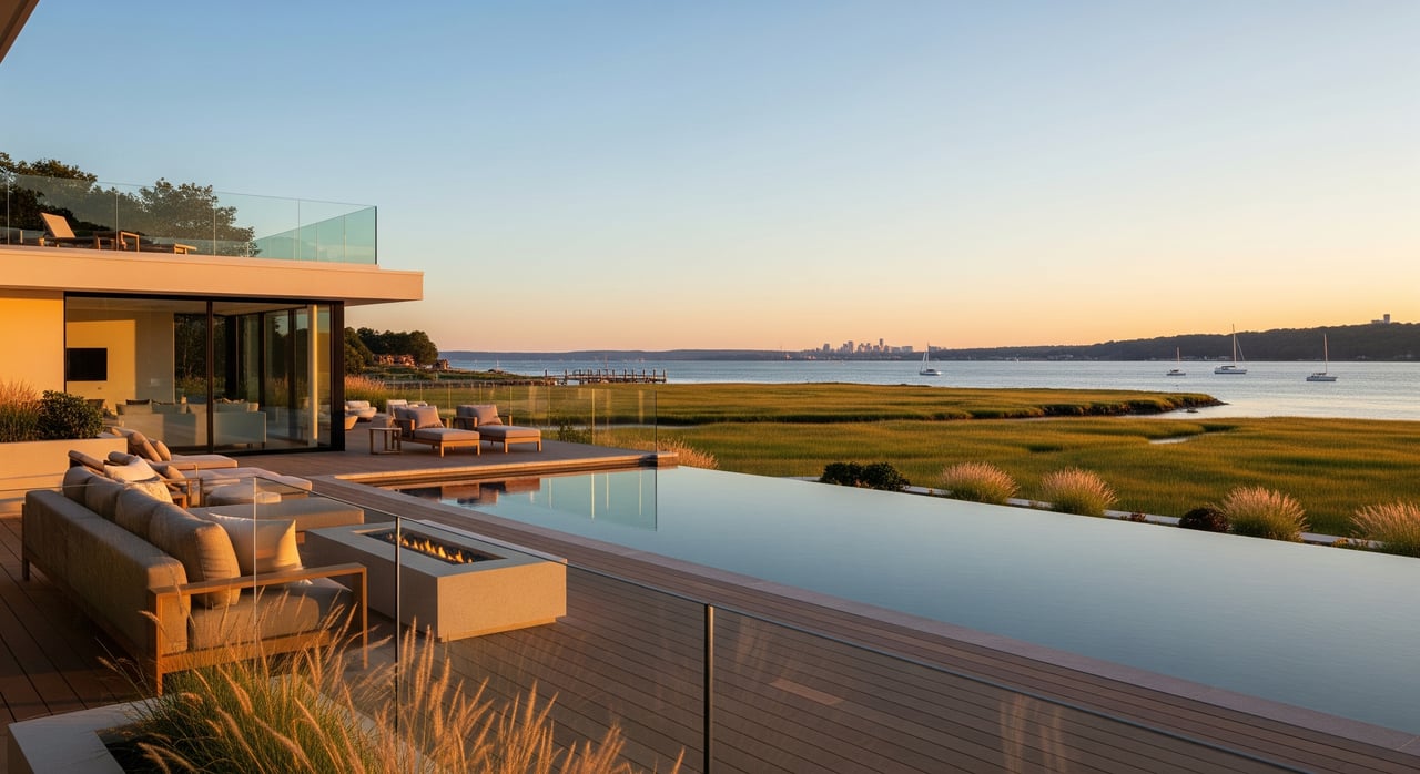
The Sound Shore typically offers a broader range of sheltered marinas, yacht clubs, and mooring fields thanks to its many inlets and coves. In places like New Rochelle, Mamaroneck, and Rye, you will find wet slips, seasonal moorings, shore power, fuel, and boat yards with haul-out and winter storage. A strong recreational boating culture supports racing programs, junior sailing, and waterfront dining. For industry context and infrastructure trends, the Marine Industries Association of New York is a helpful resource.
Hudson River marinas
Hudson-side facilities serve a tidal river with stronger currents and fewer large natural harbors. Many marinas are built for boats comfortable with current, chop, and a larger tidal swing. The main channel is deep, which is favorable for cruising and longer passages. Some locations accommodate transient slips for day and weekend trips. Riverfront uses can vary by town, from working waterfront to mixed-use promenades.
Tides, depth, and storms
Conditions differ between coasts. The Hudson is a tidal river with notable currents that affect docking and maneuvering. The Sound has tidal range and currents too, but its harbors can provide more protected anchorages. Both shorelines depend on periodic dredging in certain basins. Exposure is different as well. Sound-facing locations can be more vulnerable to nor’easters and ocean-driven surge, while the Hudson can experience combined river flooding, tidal effects, and storm debris. Use the NOAA Sea Level Rise Viewer for a long-range view of coastal exposure.
Slip logistics to verify
Buying near the water does not guarantee a slip at a nearby marina. Many facilities have waitlists, seasonal operations, or membership rules. Before you commit, confirm:
- Slip or mooring availability, size, draft, and distance from the property.
- Facility services such as fuel, power, security, winter storage, and haul-out.
- Local harbor regulations, speed zones, and launch services.
- Dredging history and storm management plans.
Architecture and setting
Hudson character
Hudson towns reflect a legacy of mills, shipping, and 19th-century growth. Expect brick mill buildings, Victorian-era homes, and walkable main streets near the river. Steeper bluffs and escarpments can deliver elevated views and multi-level lots. For heritage context and notable sites across the corridor, explore resources from Historic Hudson Valley.
Sound Shore style
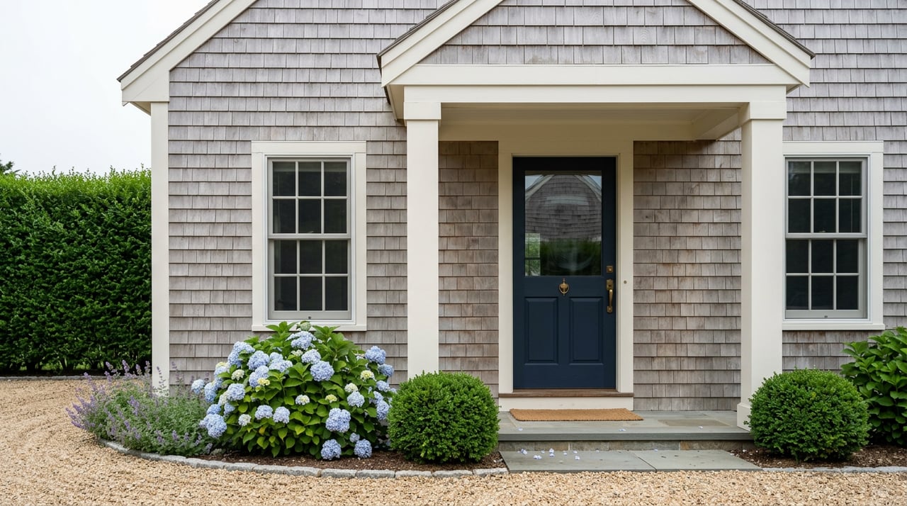
On the Sound, you will see a blend of seaside influences. Shingle-style cottages, Colonial-era structures in older villages, early and mid-20th-century houses, and modern waterfront estates are common. Neighborhoods often orient to beaches, harbor districts, and yacht clubs, with tree-lined blocks set back from the shore.
Zoning and public access
Both shorelines include waterfront overlays, floodplain rules, and state or local setback requirements. Some Hudson towns have transformed former industrial parcels into mixed-use neighborhoods with public promenades. Sound communities may balance beach preservation with incremental infill. Public paths, esplanades, and parks shape how private property meets the water. Confirm local code details before planning additions or dock work.
Commuting and connectivity
Rail to Manhattan
Both corridors have strong rail access to Grand Central. The Hudson side is served by the MTA Metro-North Hudson Line with stations in Yonkers, Hastings-on-Hudson, Dobbs Ferry, Irvington, Tarrytown, Ossining, and more. The Sound Shore is served by the MTA Metro-North New Haven Line with stations in New Rochelle, Larchmont, Mamaroneck, Harrison, Rye, and Port Chester. Express and local patterns vary by station and time. Check current schedules to compare your exact commute.
Ferries and water transit
Depending on the season and operator, ferries can provide scenic alternatives and leisure connections. Services and routes change, so confirm availability with NY Waterway and NYC Ferry before you plan around them. In Westchester, ferry options are not uniform across towns, and they can be seasonal.
Roads and parking
Sound Shore towns sit close to I-95 and I-287 with straightforward access into lower Westchester and toward Connecticut. Hudson River towns rely on east-west routes to connect with cross-county parkways and bridges. Parking rules and permit systems vary by municipality and by station area. If you plan to drive or park at rail, verify permit requirements early.
Lifestyle highlights
Sound Shore days
If you picture beach mornings and harbor evenings, the Sound Shore fits that rhythm. You will find swim beaches, sailing programs, and waterfront dining around active marinas. Residential blocks are generally suburban in feel with quick access to village centers and coastal parks.
Hudson River days
If you are drawn to dramatic views and historic village atmospheres, the river towns deliver. You can stroll riverfront promenades, enjoy cultural events tied to the region’s heritage, and explore scenic trails and parks along the corridor. For a sense of recreational assets, browse Westchester County Parks waterfront parks.
Flood, storm, and insurance
Waterfront ownership requires a clear view of risk and resilience. Both coasts include FEMA flood zones. Low-lying parcels may require flood insurance, elevation certificates, and mitigation features such as elevated systems and flood vents. Use the FEMA Map Service Center to check a specific address. For long-term exposure to sea-level rise and surge, consult the NOAA Sea Level Rise Viewer.
Costs and requirements vary by elevation, construction, and local code. Ask about past flood claims, utility elevation, bulkhead or seawall condition, and any municipal resilience plans. Many towns also coordinate with regional river and environmental groups to protect natural resources and promote safe access. For broader context, review work by Hudson River research organizations.
Buyer checklist
- Confirm your commute. Compare Hudson Line and New Haven Line schedules and station options for peak and off-peak times.
- Verify marina access. Ask about slip size, draft, waitlists, membership rules, fuel, winter storage, and security.
- Assess flood risk at the parcel level using FEMA maps and ask for elevation certificates and insurance details.
- Review resilience and maintenance. Learn dredging schedules, storm protection plans, and seawall or dock condition.
- Check local rules. Review waterfront overlays, historic districts, and setback or public access requirements.
- Compare municipal services and taxes for the exact address. School districts and fees vary by town and neighborhood.
- Visit in multiple seasons. Boats, events, and storms change the experience from winter to summer.
Which side fits you
- If you want sheltered harbors, a larger choice of marinas, and beach programming, the Sound Shore is a strong match.
- If you want dramatic vistas, walkable historic villages, and a scenic rail ride along the river, the Hudson side excels.
Your best choice depends on how you boat, how you commute, and how you like to spend weekends. With the right due diligence, both coasts deliver an exceptional Westchester lifestyle.
Ready to explore both shorelines and align your search with your goals? Request a private tour plan and a data-informed strategy with the Nest Seekers Masters Division.
FAQs
Do Westchester waterfront homes include a boat slip?
- Not necessarily. Many homes do not have deeded slips, and nearby marinas may have waitlists or membership rules. Always verify slip rights and availability directly with the marina or harbor office.
Which side has the faster commute to Manhattan?
- Both offer frequent rail service. The Hudson side uses the Metro-North Hudson Line and the Sound Shore uses the New Haven Line. The faster option depends on your station and whether you catch an express, so compare current schedules.
How can I check flood risk for a specific property?
- Search the address in the FEMA Map Service Center and request elevation certificates or prior insurance details from the seller. Review long-term exposure with NOAA’s Sea Level Rise Viewer and local building requirements.
Are ferries a reliable daily commute in Westchester?
- Ferry services and routes can be seasonal or limited by operator decisions. Always confirm current routes and schedules with the ferry operator before relying on them for daily commuting.
What should boat owners confirm at Westchester marinas?
- Ask about slip dimensions and draft, electrical service, fuel, security, haul-out capacity, winter storage, waitlists, and dredging. Confirm travel time from the property to the marina and any membership policies.
How do tides and currents differ between the Hudson and the Sound?
- The Hudson is a tidal river with stronger currents that influence docking and route planning. The Sound also has tides and currents, but harbors often provide more sheltered conditions for anchoring and moorings.